Google Earth Download
Earth and Google Earth Pro offer a 3D look and 360-degree navigation to and around almost any location in thousands of regions and millions of neighborhoods and communities on Earth.
Software details
Software Description
Offering a unique opportunity to “travel the world without leaving your seat,” Google Earth uses remarkable digital technology to place “the whole world in your hands.” The leading geographical browser (or “geobrowser”) on the market today, this computer program is available free of charge as both an online website and a mobile application.
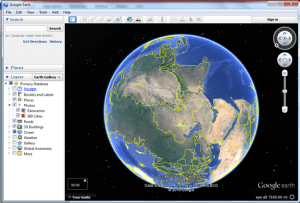
Drawing upon actual satellite and aerial imagery, Google Earth digitally renders the entire Earth into a highly accurate, interactive, and user-friendly globe. It creates this virtual globe by seamlessly integrating and superimposing overhead images with established geographic information system (GIS) data. Users can instantly transition from a two-dimensional (2D) to a three-dimensional (3D) viewpoint with the click of a tab.
Using
Google Earth allows users to pan, rotate, and tilt the entire Earth as well as zoom in and out of virtually any location on its surface. From an initial global perspective, a simple point and click can bring a wider range of geographic details into sight.
At its closest to the ground, Google Earth provides remarkable residential and commercial street views. From the biggest city to the tiniest village, all of human civilization appears on Google Earth as reflected by the latest available information.
Thanks to its straightforward and intuitive “point and click” navigation, Google Earth is designed to accommodate users of all ages with a bare minimum of knowledge or skill. Even better, users can see landscapes, cities, features, and structures from a variety of angles.
Google Earth provides a highly immersive 360° perspective at its Street View level, allowing you to take a virtual “stroll” past your home or any other. In addition to showing existing buildings and land topography, the various versions and tools of Google Earth can show ocean bathymetry and layers of terrain.
Version 10
The latest version of Google Earth Version (Version 10) provides smooth and instant access to all the above maps with the click basic mouse or the touch of a touchscreen. It also included a variety of bug fixes as well as updates to support the Apple Pencil stylus and measuring tool.
Version 10 continues to feature the massive Voyager platform that Google Earth first introduced in 2017 and has refined and expanded ever since. A showcase of interactive guided tours, lectures, and stories, Voyager employs all of Google Earth’s technological capabilities to answer important questions and impart critical information in a highly informative, entertaining, and immersive way.
The hundreds of presentations on Voyager are produced in conjunction with authoritative scientific organizations such as National Geographic, BBC Earth, and NASA. The power of its multimedia demonstrative approach is evident in its Warming Planet time-lapse presentation, which not only tells users about the dangers of global warming projections but shows them these dangers in the form of submerged coastlines and flooded cities.
Google Earth Pro
For users who want even more advanced features, Google Earth offers its downloadable Google Earth Pro version for desktop devices only. With Google Earth Pro, users can harness the power of the Google Earth platform for their own proposes by importing specific GIS information or creating new data of their own. Once in the system, this third-party information/data can be employed to create topographical displays in multiple layers on any digital map.
Other advantages of Google Earth Pro include the ability to measure geographic areas using geometric triangulation, save images at very high levels of resolution, and import both MapInfo tab files and ESRI shapefiles. It even has movie-making capabilities.
In short, Google Earth Pro offers many advantages over the standard Google Earth platform. Like the standard platform, however, it is available to the general public entirely free of charge.
Google’s Geo Tools
People turn to Google Earth for a wide variety of reasons. To give its users more autonomy to make the platform their own, Google Earth offers a suite of supportive tools as part of its Google Earth Outreach and Google Earth Education initiatives.
The tools of Google Earth Outreach were specifically designed to help people take action to solve social problems or reverse environmental destruction. These tools range from its ecological restoration platform Restor to its comprehensive digital events hub.
Google Earth Education is a collection of tools that can be used in virtually any classroom. Teachers can take their students on an architectural tour of Barcelona, trace Marco Polo’s voyage through Asia, and evaluate the habitat of the Cameroon grassland frog.
Public Reception and Ratings
The most popular geobrowser in the world, Google Earth is appropriate for the whole family. In addition to its widely visited website, its mobile application has been well received on all the leading app installation platforms. For example, its public review ratings exceed 4 out of 5 stars on both Google Play and the Apple Store. Furthermore, the Apple Store ranks Google Earth as the 15th post frequent download among its thousands of travel apps.
